Live Webcam Mountain Road Condition and Pass Cameras in Oregon
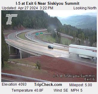
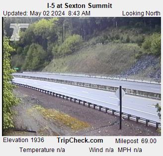
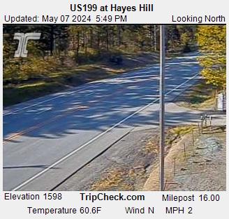
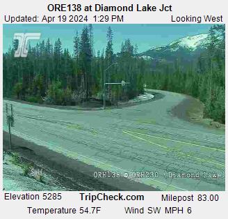
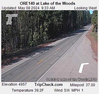
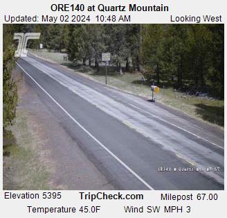
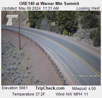
including Siskiyou Pass, Greensprings, Sexton Summit, Lake of the Woods, Diamond Lake, Timberline Lodge, Santiam Pass & Willamette Pass
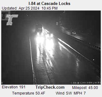
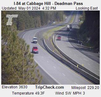
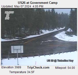


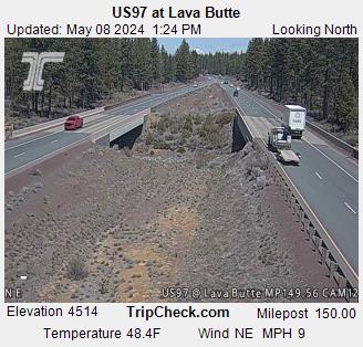
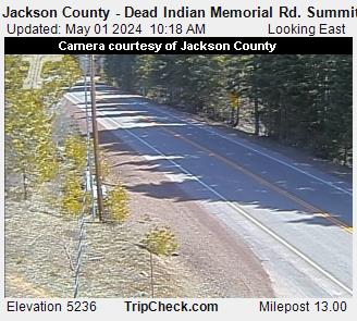
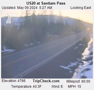
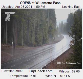
Wait for all mountain pass images to load, then click image for larger picture


Interstate 5 at Siskiyou Summit, elevation 4310 feet.  Camera is occaisionally down; be sure to check date and time on the picture to be certain  it is up-to-date. Courtesy Oregon Department of Transportation. Interstate 5 Siskiyou Exit 6, elevation 4060 feet, between Ashland Oregon and Yreka California.  Courtesy Oregon Department of Transportation. Highway 66 east of Ashland Oregon
I-5 Siskiyou Pass
(TripCheck.com)

I-5 Siskiyou / Mt. Ashland Exit 6
(TripCheck.com)

Oregon 66 Greensprings
(www.Green-Springs.net)

I-5 at Sexton Mountain Pass, view north. Courtesy ODOT. Redwood Highway 199 Hayes Hill Summit.  Camera is occasionally down; be sure to check date and time on the picture to be certain  it is up-to-date. Courtesy Oregon Department of Transportation. Oregon 138 / Oregon 230 near Diamond Lake. Camera is occasionally down; be sure to check date and time on the picture to be certain  it is up-to-date. Courtesy Oregon Department of Transportation.
I-5 Sexton Mtn., view north
(TripCheck.com)

Redwood Hwy 199, Hayes Hill
(TripCheck.com)

Hwy 230/138 nr Diamond Lake
(TripCheck.com)

Highway 140 near Lake of the Woods, between  Medford and Klamath Falls, Oregon.  Courtesy Oregon Department of Transportation. Hwy 140 Quartz Mountain Warner Summit
Hwy 140 Lake of the Woods
(TripCheck.com)

Hwy 140 Quartz Mountain
(TripCheck.com)

Hwy 140 Warner Mountain
(TripCheck.com)

Cascade Locks Cascade Locks Deadman Pass-Cabbage Hill
I-84 Cascade Locks, west
(TripCheck.com)

I-84 Cascade Locks, east
(TripCheck.com)

I-84 Cabbage Hill,
Deadman's Pass (ODOT)

Timberline Lodge Government Camp Hwy 97 Lava Butte
Timberline Lodge, Mt Hood
(Timberline Lodge/USFS)
Hwy 26 Government Camp
(TripCheck.com)

Hwy 97 Lava Butte
(TripCheck.com)

Dead Indian Memorial Road summit between Ashland and Lake of the Woods, Oregon, courtesy Jackson County Oregon and ODOT. Santiam Pass Hwy 58 Williamette Pass
Dead Indian Memorial Hwy summit
(Jackson County & ODOT)

Santiam Pass
(TripCheck.com)

Hwy 58 Willamette Pass
(TripCheck.com)


colorline

ODOT Road Information


colorline

More Weather Related Information...

Forecasts    Roads   Skiing    Rivers   Fires    Earthquakes   
Interstate 5 Oregon    Interstate 5 California    Interstate 5 Washington
Hwy 140    Hwy 97    Hwy 395    Hwy 101


colorline

More from Medford Fuel...

Pacific Pride Commercial Fueling   Monitor Stoves
Efficient Home Heating   Oil Heat Information


Medford Fuel Home Page
billterpeningmedford.com

'Page design copyright © Bill Terpening / Medford Fuel.   All Rights Reserved.    Camera images are the sole property of their respective owners.    Medford Fuel makes no warranty as to the accuracy or timeliness of the images displayed, and as such, viewers should not use displayed images as a basis for making travel decisions.    Conditions can change rapidly.    Camera images can be subject to various problems, including camera malfunction, transmission failures, server outages, Internet traffic congestion, adverse weather conditions, etc.    Medford Fuel has no control over operation of the cameras; they are provided here as a convenience only.
Site design by Cascade Web Works

Cascade Web Works Cascade Web Works